
3 Scenic Hikes in Sedona
When you visit Sedona, you instantly fall in love. When we visited I very much wanted it to be a get lost and explore kind of trip and I wasn’t disappointed.
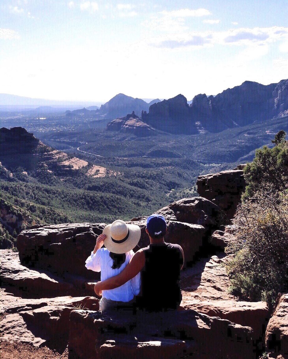
Sedona is located between the Coconino and Yavapai county lines. It is near Flagstaff and surrounded by red-rock buttes, high canyon walls and pine forests. Sedona is an Arizona desert town noted for its mild climate and lively arts community. You will find many New Age shops, spas and art galleries in uptown Sedona. There are numerous trailheads on the outskirts across Red Rock State Park, which provides bird-watching, hiking and picnicking spots.
As a couple we prefer easy to moderate hikes as we don’t want to carry too much gear, so here are three of my personal favourites in Sedona. If you’re stuck for time and trying to decide which to do or just wanting to find scenic spots then this post is for you. I also recommend getting up early and doing your hikes so that you finish around lunch-time, the trails aren’t too busy and it also gives you the rest of the day to explore.
When hiking in the red rock area you must also have a pass which you can buy daily or weekly or annually, but must be displayed in the front of your car.
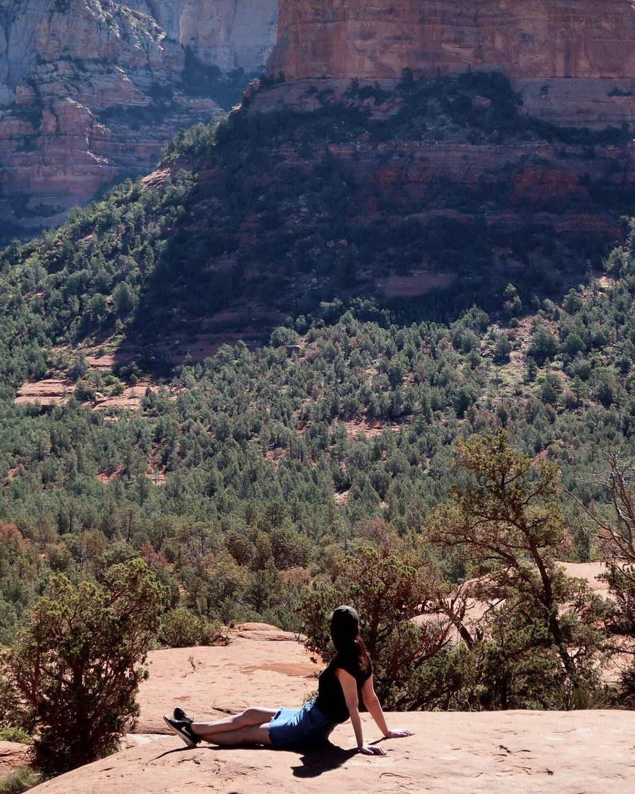
Little Horse Trail
Distance of hike: 3 miles
Time: 2.5 hours round trip
Difficulty: Easy
Where to start: Little Horse Trailhead parking
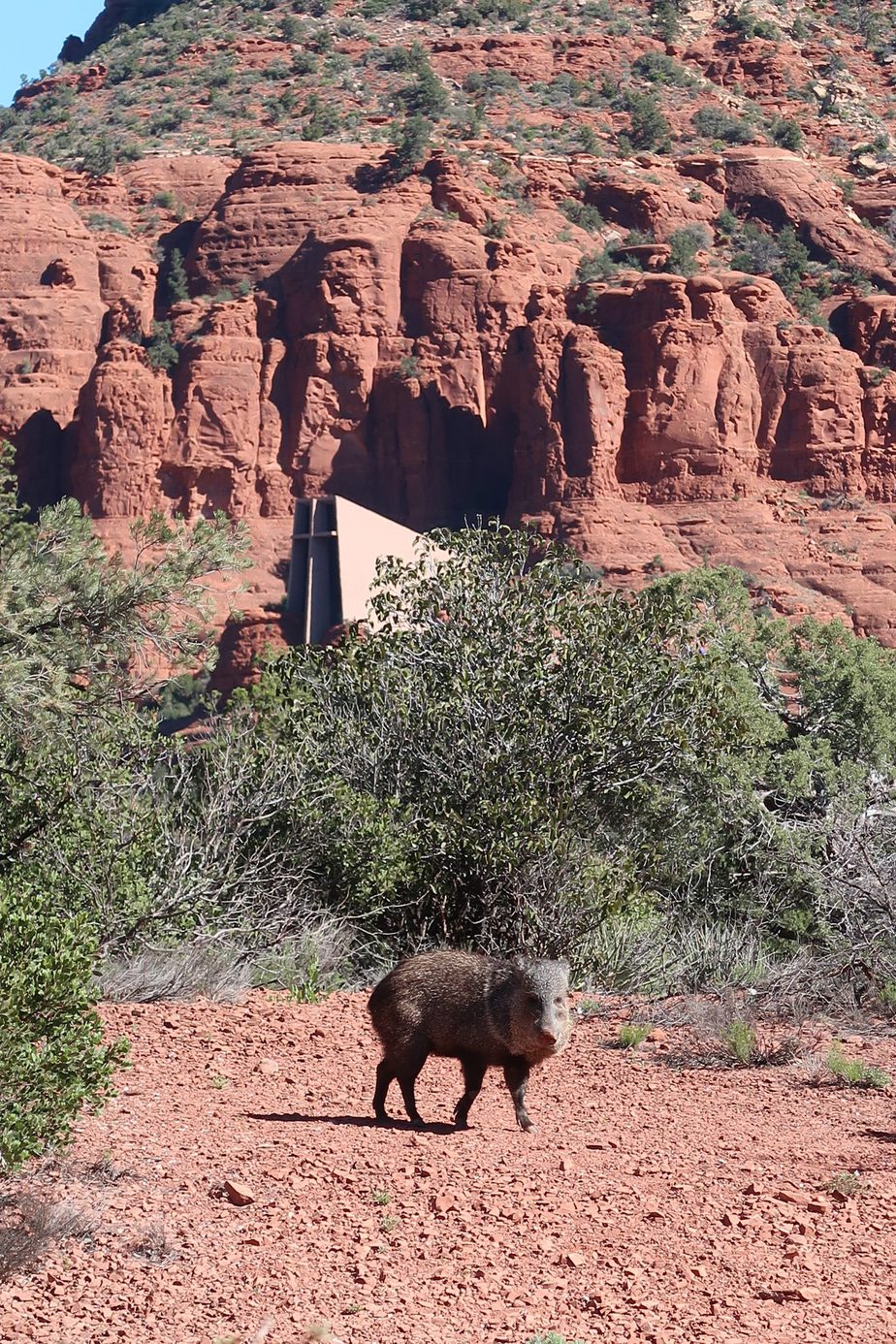
This trail ends at Chicken point and starts at Bell Rock Pathway. It is well sign posted and forks to where you can either head to Chicken Rock and views of The Two nuns or the Chapel of the Holy Cross.
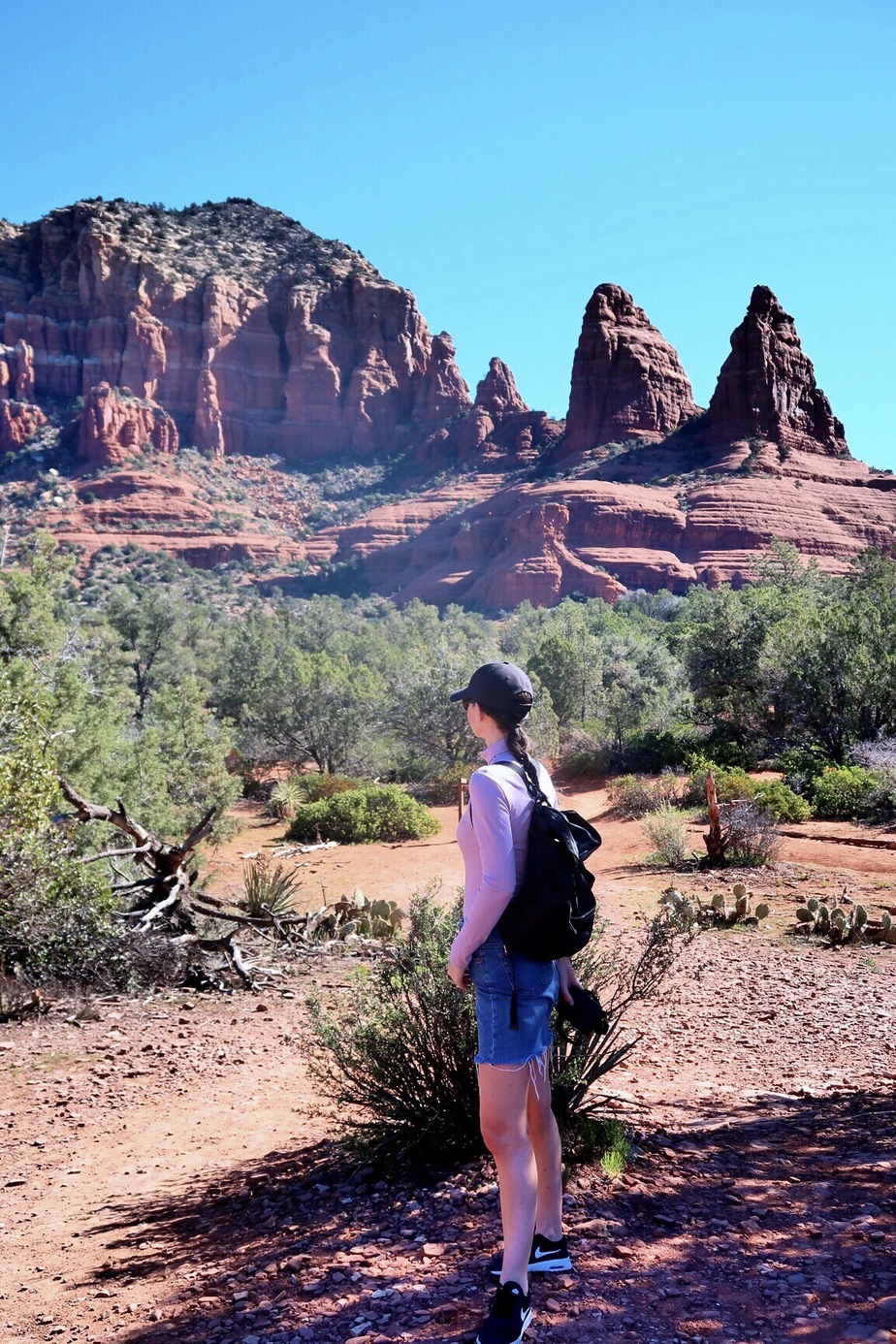
It’s a very easy trail with beautiful views and if you arrive early enough, you may even get to see some wildlife like we did.
We started with this hike to get a taste of things to come, and we loved how quiet it was first thing and to really feel like we were escaping into nature.
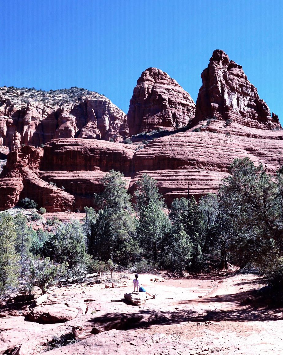
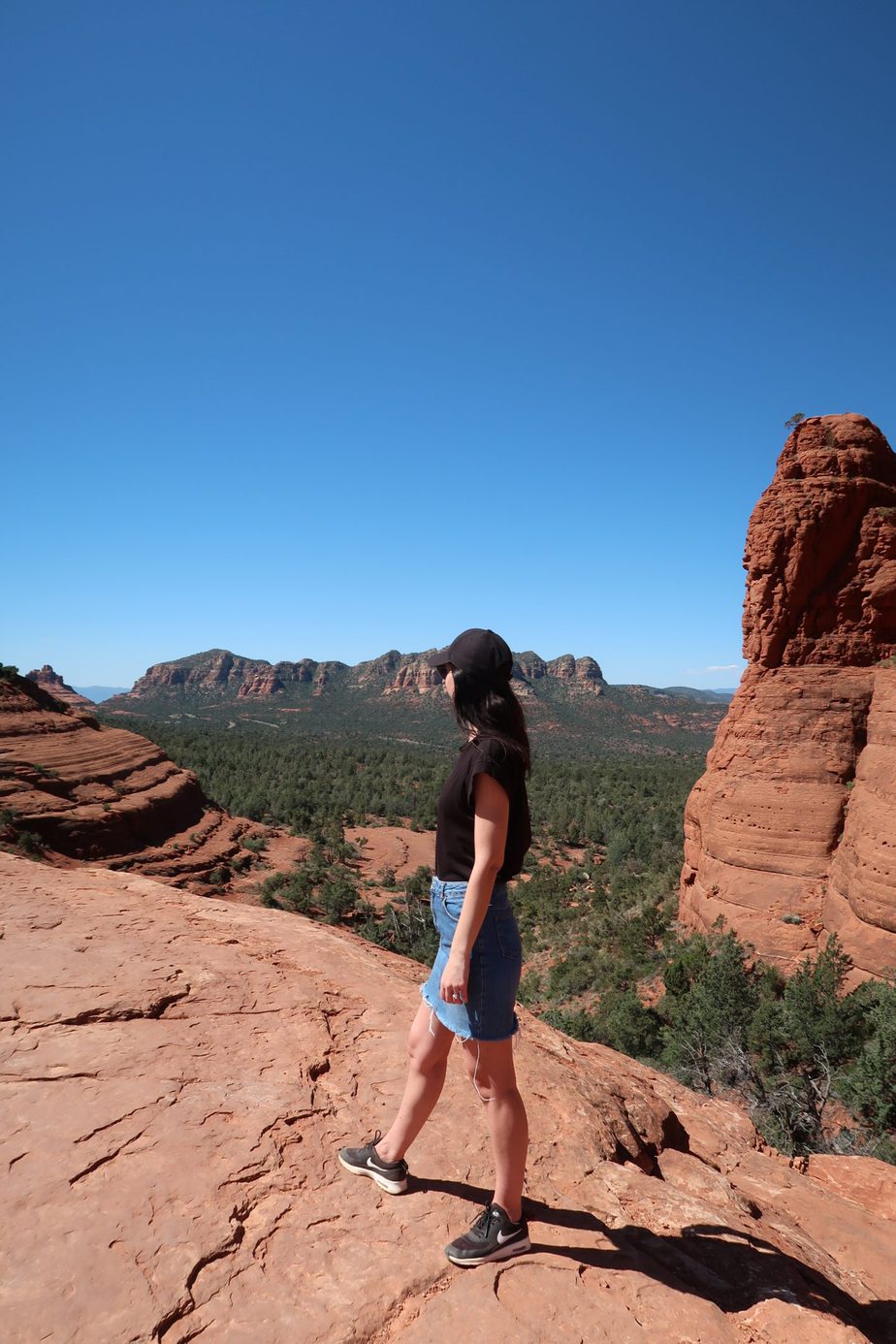
Broken Arrow Trail
Distance of hike: 3.5 miles
Time: 2.5 hours round trip
Difficulty: Easy to moderate
Where to start: Broken Arrow Trailhead parking
This is one of the most popular hikes in the area, especially for mountain bikes. We found the parking to be limited, so again, arrive early. As you head toward Chicken Point the views along the way are worth it.
Along the route you will see Submarine Rock, Twin Buttes and finally the famous Chicken Point.
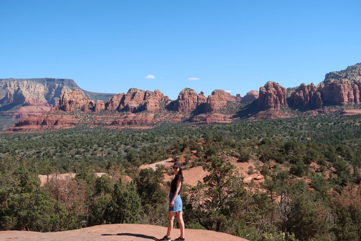
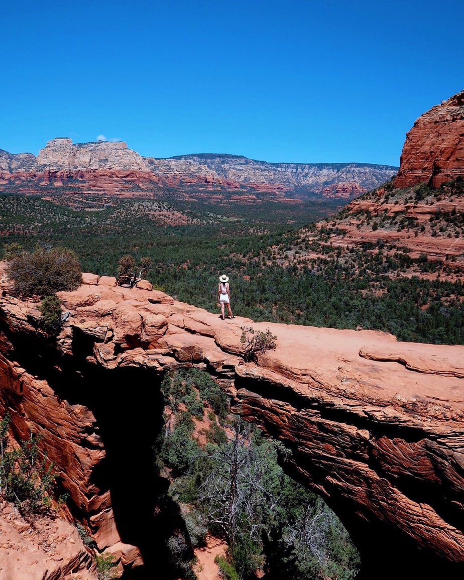
Devils Bridge Trail
Distance of hike: 4.2 miles
Time: 3 hours round trip
Difficulty: Moderate with steep climbs at the end that require use of hands.
Where to start: Devils Bridge Trailhead parking
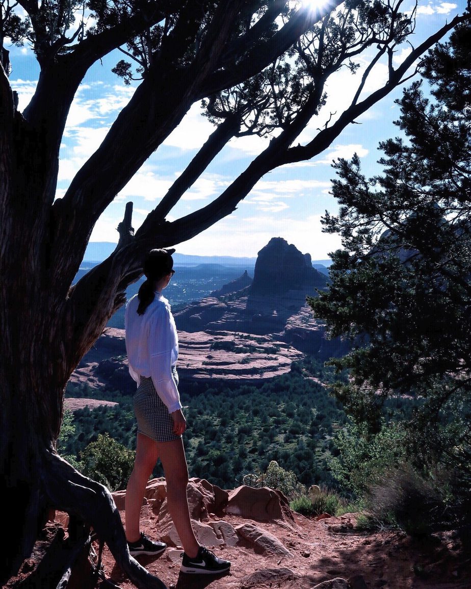
Possibly the most famous and most-instagrammed hike in Sedona. Devils Bridge is the largest natural sandstone arch in Sedona and offers stunning views of red-rock country.
Be aware that this hike is very popular and can be quite strenuous climbing to the top of the bridge in the hot weather. Arrive early, as parking is also very difficult at this trailhead and take plenty of water.
The trail itself is fairly flat until you get to the last mile or so where it starts to climb. You will first find a natural rock staircase which will lead you to some fantastic views.

At this stage, it’s wise to have a short break before ascending to Devils Bridge. The climb is narrow and people will be descending at the same time, so be careful!
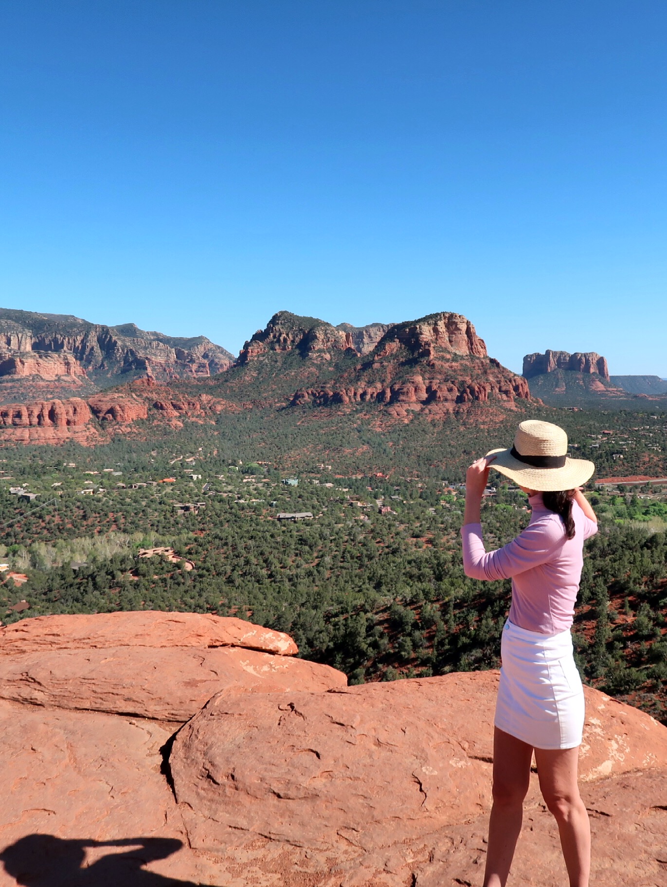
And if you don’t want to walk…
I highly recommend getting the Mogollan Rim tour with Pink Jeep Tours. This 3 hour (very bumpy) tour starts on Schnebly Hill Road and historic Munds Wagon Trail, heading through canyons and over rocky trails. You’ll travel up to iconic Merry-Go-Round Rock and past the Cow Pies rock formations.
Here are some of the views:
What are your favourite hikes in Sedona?
You May Also Like:


9 Must-Visit Places in the UK
Looking for travel inspiration for a UK staycation? Discover my top 9 must-visit places in the UK for 2023, including Bath, the Cotswolds, Loch Lomon and Cambridge… We’re really lucky in the UK - we have so many amazing places to visit, right on our doorstep. From...

The Best Places To Visit In Puglia
Puglia is a Southern region of Italy located in the heel of the country’s famous “boot”. It is surrounded by large expanses of water, to the east the Adriatic Sea, to the southeast the Ionian Sea and to the south the Gulf of Taranto and the Strait of Otranto. The...

Waterfall Chasing | 5 Must-See’s in Yosemite National Park
I truly believe that rejuvenation not only happens in a spa or place of rest, but by being in nature. One of my favourite places to do this has to be Yosemite National Park in California where the air is fresh and you can really get back to basics. The iconic Tunnel...

9 Places to Visit in North Wales
From castles and beaches, to waterfalls and quaint towns and villages, North Wales has so much to offer. Well known for its beautiful coastline, stunning landscape and rich history, there’s a lot to discover here. I’ve been several times in the winter, and I loved...

8 Amazing Things to do in Dubai
Dubai is one of my all time favourite places to visit, especially as it offers an opportunity to get some winter sun. It’s one of the most popular travel destinations in the world, and once you’ve been, you’ll find yourself being drawn back time and time again. During...

The Best Of Bath, UK – Places You Must Visit
It really isn’t difficult to see why Bath is regularly voted into the top 10 cities to visit in the UK. This stunning city in Somerset is named for the Roman built baths that you will find here, and these are well worth a visit (more about that in a moment). I was...

Where to Stay in Berlin: Hilton Berlin
Berlin is a truly fantastic city to visit, and best of all, it takes less than two hours to fly to Berlin from London. Perfectly located within walking distance of the city’s main attractions, the Hilton Berlin offers luxury accommodation and much more. This is the...

Dubai Hotels: Mövenpick Hotel Apartments Downtown Dubai
This 5-star hotel in Downtown Dubai is a great option if you’re looking to base yourself right in the middle of the best of what Dubai has to offer. With various landmarks, attractions, bars and hotels on your doorstep, Mövenpick Hotel Apartments in Downtown Dubai...

Dubai Hotels: Sheraton Mall of Emirates
Dubai is an amazing city with so much to offer. One thing that’s particularly good in Dubai is shopping, and the Sheraton Mall of Emirates hotel is the perfect place to stay if you’re hoping to spend some time at the Mall of Emirates. This 5-star hotel not only serves...

Everything you Need to Know About: Platinum Heritage Dubai
If you’re planning a trip to Dubai and you want to do a desert safari, Platinum Heritage Dubai provides the ultimate experience. The most awarded safari in Dubai, I absolutely loved what Platinum Heritage had to offer and it’s one of my most memorable trips. ...
0 Comments